northbound on State Route 9
northwest geology field trips
- Field trip to the Wells Creek volcanics, North Fork Nooksack River (nwgeology.wordpress.com)
The Wells Creek Volcanic Member of the Nooksack Formation (Tabor and others, 2003; see refs below) is found in the vicinity of Nooksack Falls, east of Glacier, Washington. These Middle Jurassic island arc rocks form steep yellowish cliffs along the Mount Baker Highway (Route 542) just east of the Excelsior Pass trailhead, where they crowd the highway against the deep gorge of the North Fork Nooksack River…
- On OSM, there isn’t a specific element for just the north fork.
- Home Computers: 100 Icons that Defined a Digital Generation (techtinkering.com)
As soon as you pick up this coffee table style book you know that you’re in for a treat. A quick flick through reveals page after page of beautiful photos accompanied by well layed out text describing each machine. Turning to the introduction and you get what feels like an art documentary script that proceeds with great pace as it explains the rise of home computers. The intro captures much of the excitement, wonder and frenetic energy of this time.
southbound on State Route 9
- Nooksack River § North Fork (Wikipedia)
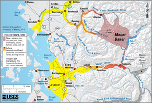
The North Fork Nooksack River rises at the Nooksack Cirque east of Mount Shuksan within the western part of North Cascades National Park in central Whatcom County. Gathering meltwater off East Nooksack Glacier, it flows generally west past north of Mount Baker. For most of its course, this fork is paralleled by State Route 542 (also called the Mount Baker Highway). The river picks up large creeks such as Price Creek, a short creek draining Price Lake; as well as Ruth Creek, before the uppermost highway bridge crosses it.