- Columbia Gorge Field Trip: Troutdale Formation and Boring Basalt (cwmh2o.com)
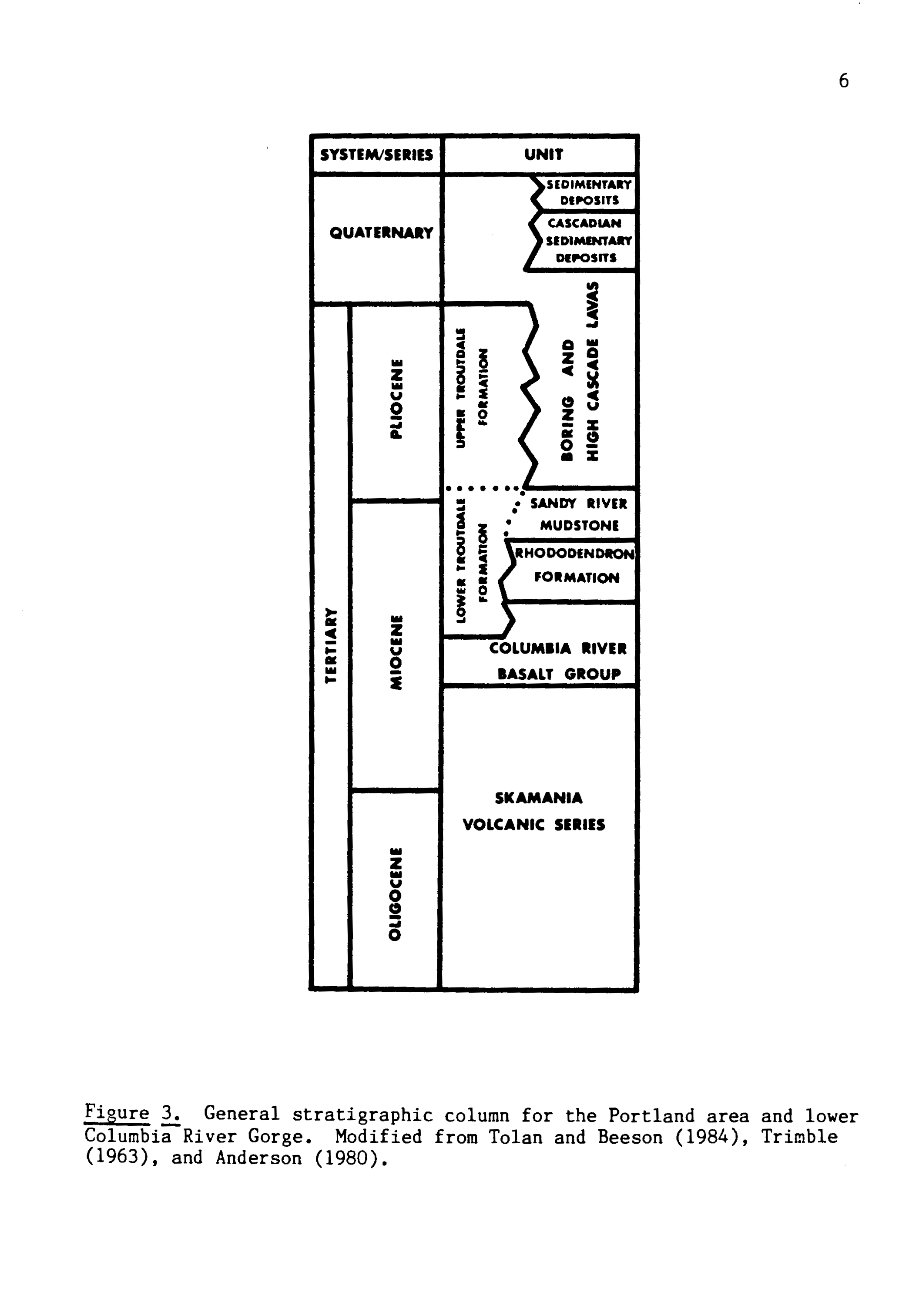
The CwM team could not resist the early summer-like weather in the Pacific Northwest and took a “Geology-Friday” field trip into the Columbia River Gorge. Their trip took them east from Portland to the Sandy River, along the Historic Columbia River Highway through Corbett, with stops at the Latourell and Bridal Veil Falls, and back west along the banks of the Columbia River. The goal was to find outcrops of the Troutdale Formation, parts of which make up an important groundwater source in the Portland metro area and part of the City of Portland’s Columbia River Wellfield.
stratigraphic-geochemical study