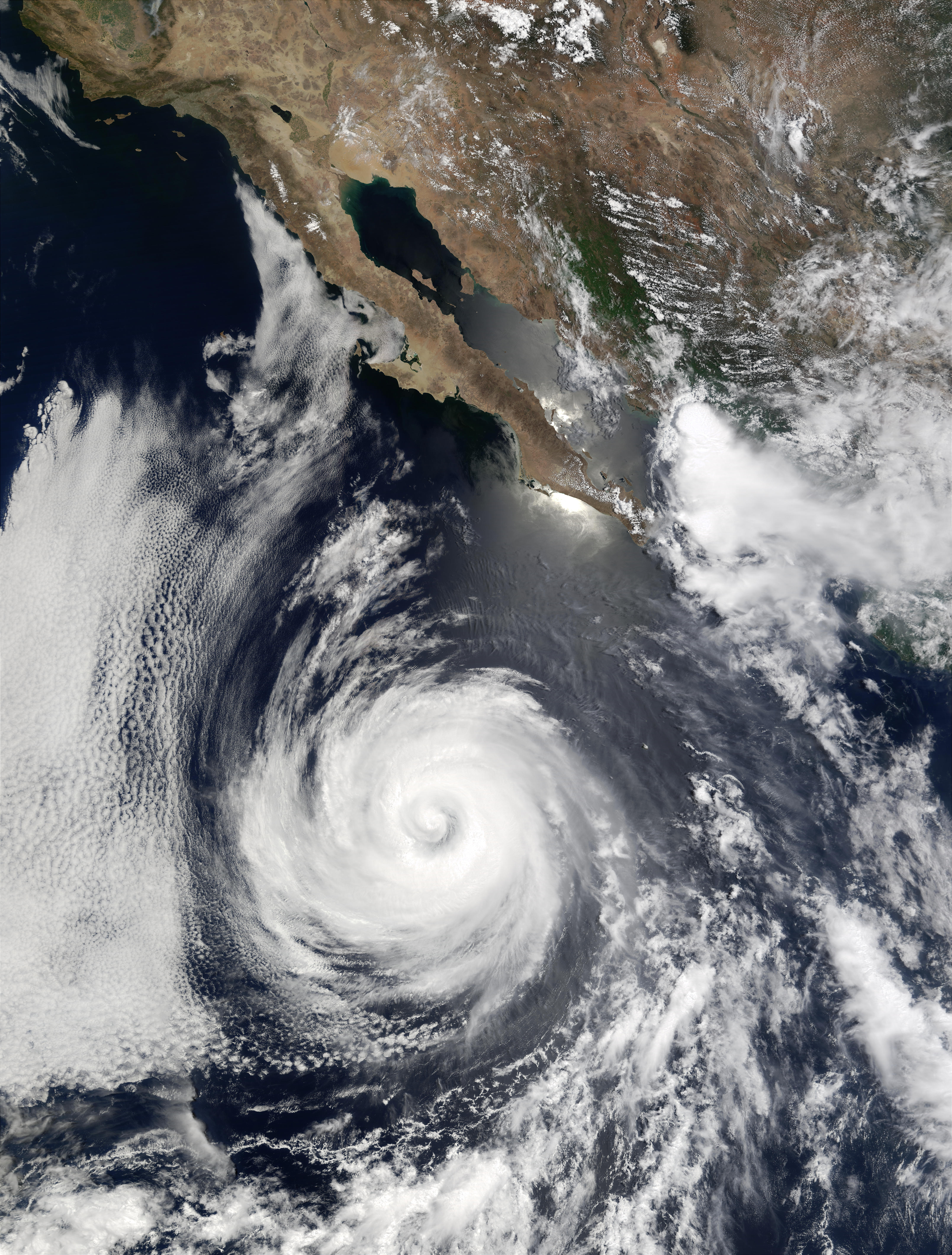
- Jacques Descloitres, MODIS Land Rapid Response Team, NASA/GSFC
- As recently as July 23, 2002, Hurricane Douglas was a category 2 hurricane, with winds as high as 90 knots (over 100 miles per hour). As of July 24, Douglas had dropped back to category 1 status as it moved away from the Baja California Peninsula in the eastern Pacific Ocean. The storm is predicted to continue moving westward over the next 24 hours and should weaken as it moves over cooler waters. This image was acquired by the Moderate Resolution Imaging Spectroradiometer (MODIS) on the Terra satellite on July 23, 2002.
- Satsop River (Wikipedia)
The Satsop River is a stream in the U.S. state of Washington. It has three main tributary forks, the East Fork, West Fork, and Middle Fork Satsop Rivers. The main stem Satsop River is formed by the confluence of the West and East Forks. The Middle Fork is a tributary of the East Fork. The three forks are much longer than the main stem Satsop itself, which flows south from the confluence only a few miles to join the Chehalis River near Satsop, Washington. Other significant tributaries include the Canyon River and Little River, both tributaries of the West Fork Satsop, and Decker Creek, a tributary of the East Fork Satsop River. The Satsop River’s major tributaries originate in the Olympic Mountains and its southern foothills, the Satsop Hills, within Grays Harbor and Mason counties. Most of the Satsop River’s watershed consists of heavily wooded hill lands. The upper tributaries extend into Olympic National Forest, approaching but not quite reaching Olympic National Park.